Czech Republic Atlas (English, French, Italian and German Edition)
![]()
Czech Republic Atlas (English, French, Italian and German Edition)
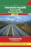
Spiral-bound road atlas of the Czech Republic at 1:150,000 scale (1.5 km per cm) that depicts elevation with shaded-relief and color tinting. Map shows highways and roads, rail lines, airports, distances in kilometers, natural features, parks, and places of interest. Includes mileage chart, administrative districts, and extensive placename index. Also included are detailed city maps for Brno, Ceske Budejovice, Hradec Kralove, Jihlava, Karlovy Vary, Ostrava, Pardubice, Praha (Prague), Plzen, Usti nad Labem, and Zlin. Includes section on Europe at 1:3.5 million scale (35 km per cm). Legend in Czech, Italian, German, English, French.

List Price: $ 29.95
Price: $ 23.61
![]()
No comments:
Post a Comment